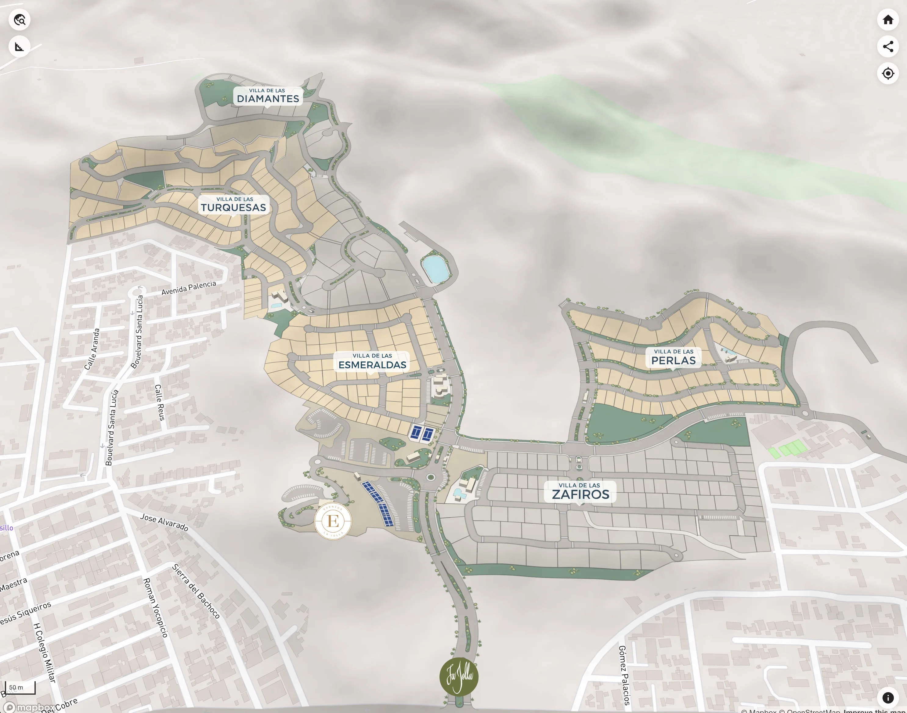
La facilidad de Google Maps con la información de tu proyecto
Muestra tu masterplan a detalle con su inventario e información del proyecto, siempre actualizado y siempre disponible.
El Problema
El problema con los masterplans hoy
Los PDFs estáticos se desactualizan. Las hojas de cálculo confunden a los compradores. Tu equipo de ventas pasa más tiempo explicando que vendiendo. Y los prospectos siguen sin entender dónde está cada cosa.
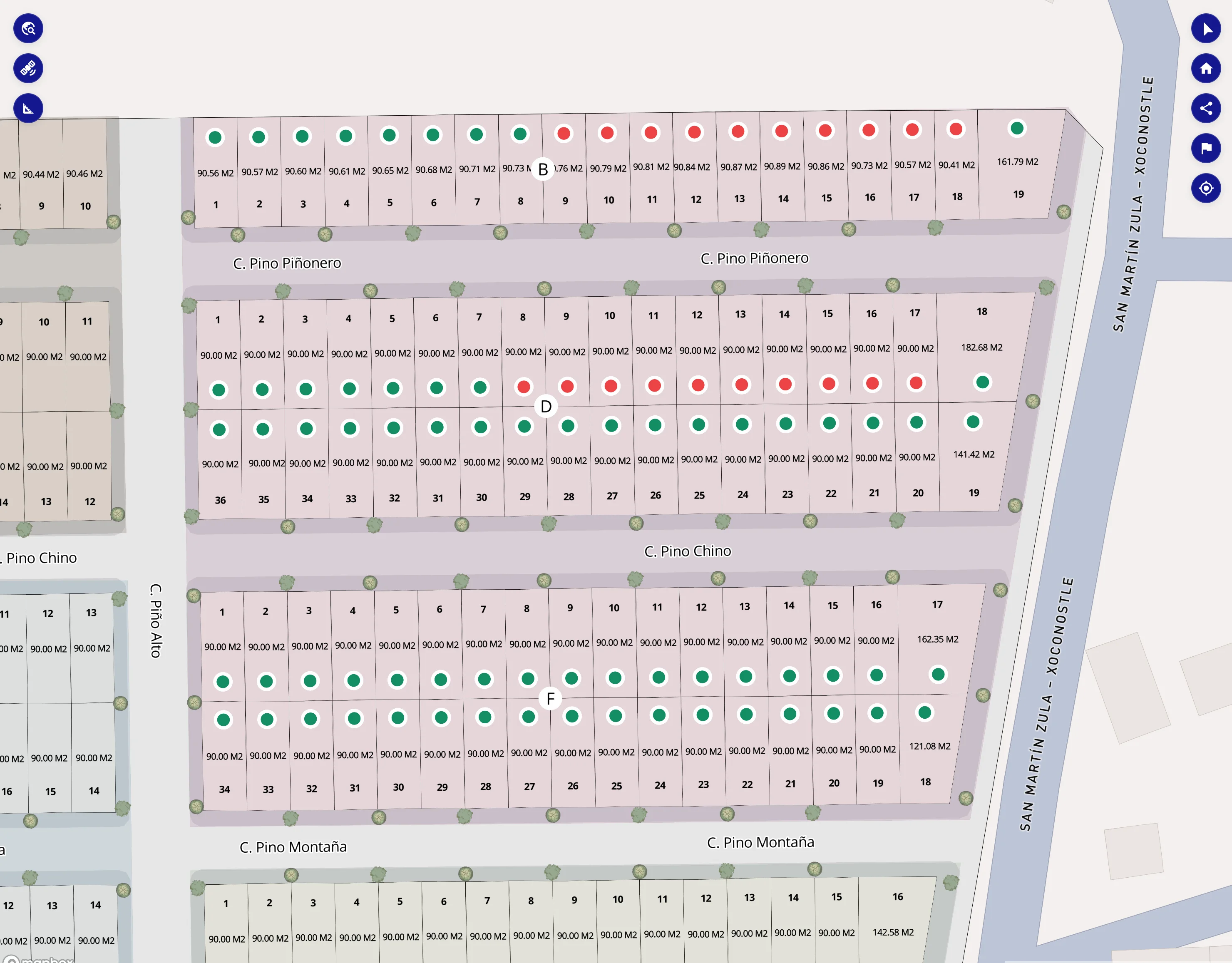
PDFs o Imágenes Estáticas
Los masterplans se desactualizan en el momento en que se imprimen o se exportan como imagen. Los cambios implican re-exportar, re-enviar, re-explicar.
Hojas de Cálculo Confusas
Los compradores no pueden conectar la fila 247 con una ubicación física. Tu inventario vive en un formato que nadie fuera de tu equipo entiende.
Atrapado en Software CAD
Tu masterplan vive en AutoCAD o Civil 3D — herramientas que requieren conocimiento técnico. Nadie fuera de ingeniería puede abrirlo, leerlo o compartirlo.
Disponibilidad Desactualizada
"¿Ese lote sigue disponible?" Nadie lo sabe con certeza sin revisar tres fuentes diferentes.
La Solución
Deja que tu proyecto se explique solo
Transforma tu masterplan en un mapa interactivo donde cada unidad es explorable, el inventario se actualiza en tiempo real y un solo enlace le da a cualquiera claridad total del proyecto.
"Deja de explicar tu proyecto. Deja que la gente lo explore."
- ✓ 100% en el navegador — sin instalación
- ✓ Siempre actualizado — sin sincronización manual
- ✓ Funciona en escritorio, tablet y móvil
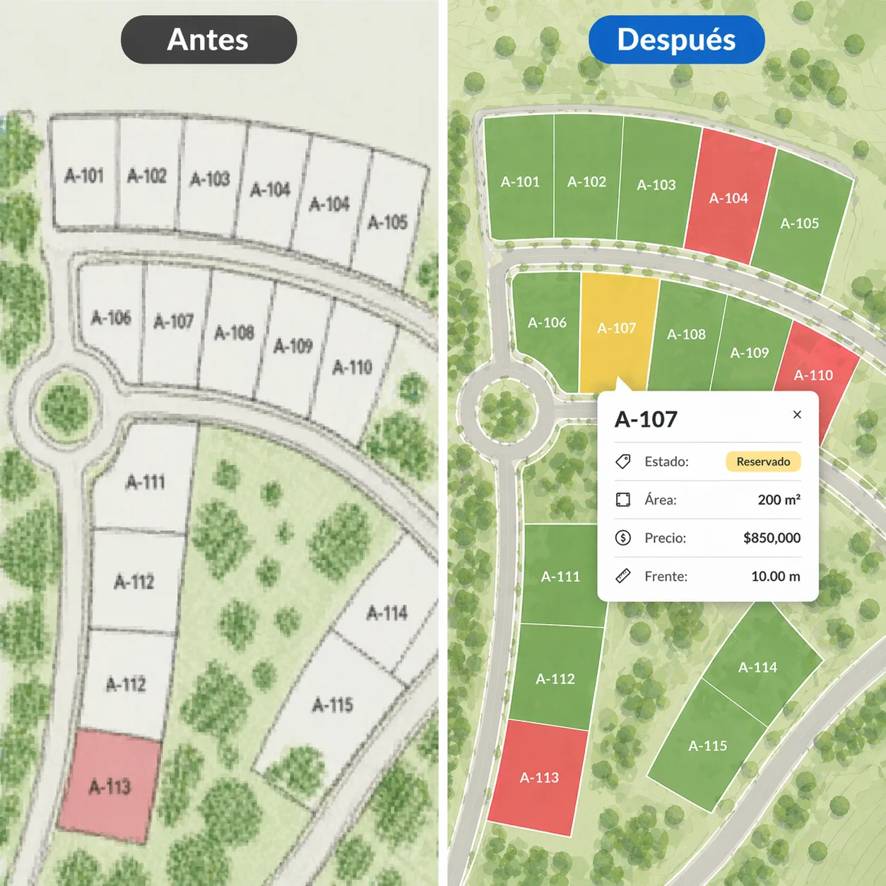
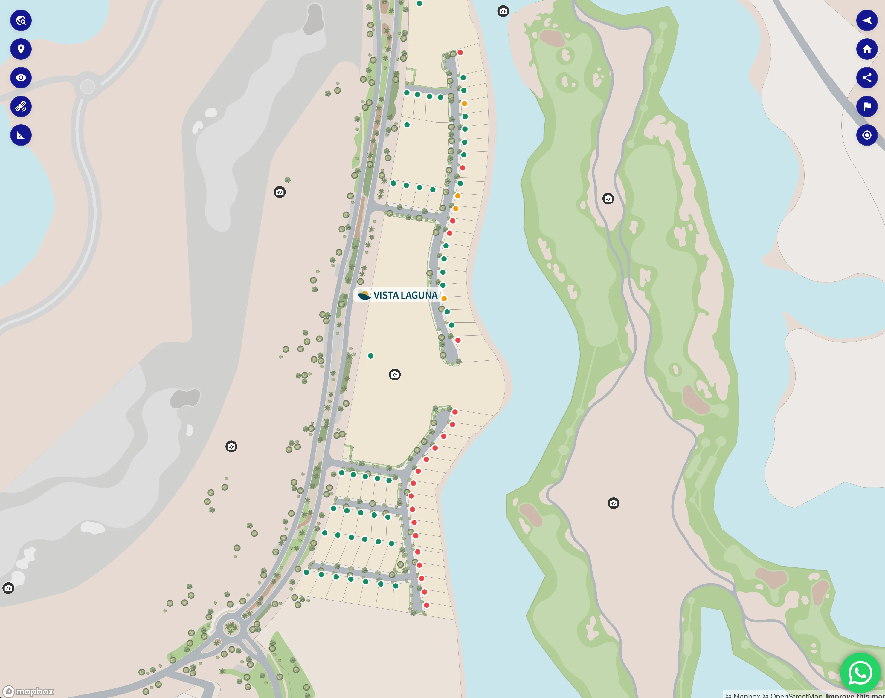
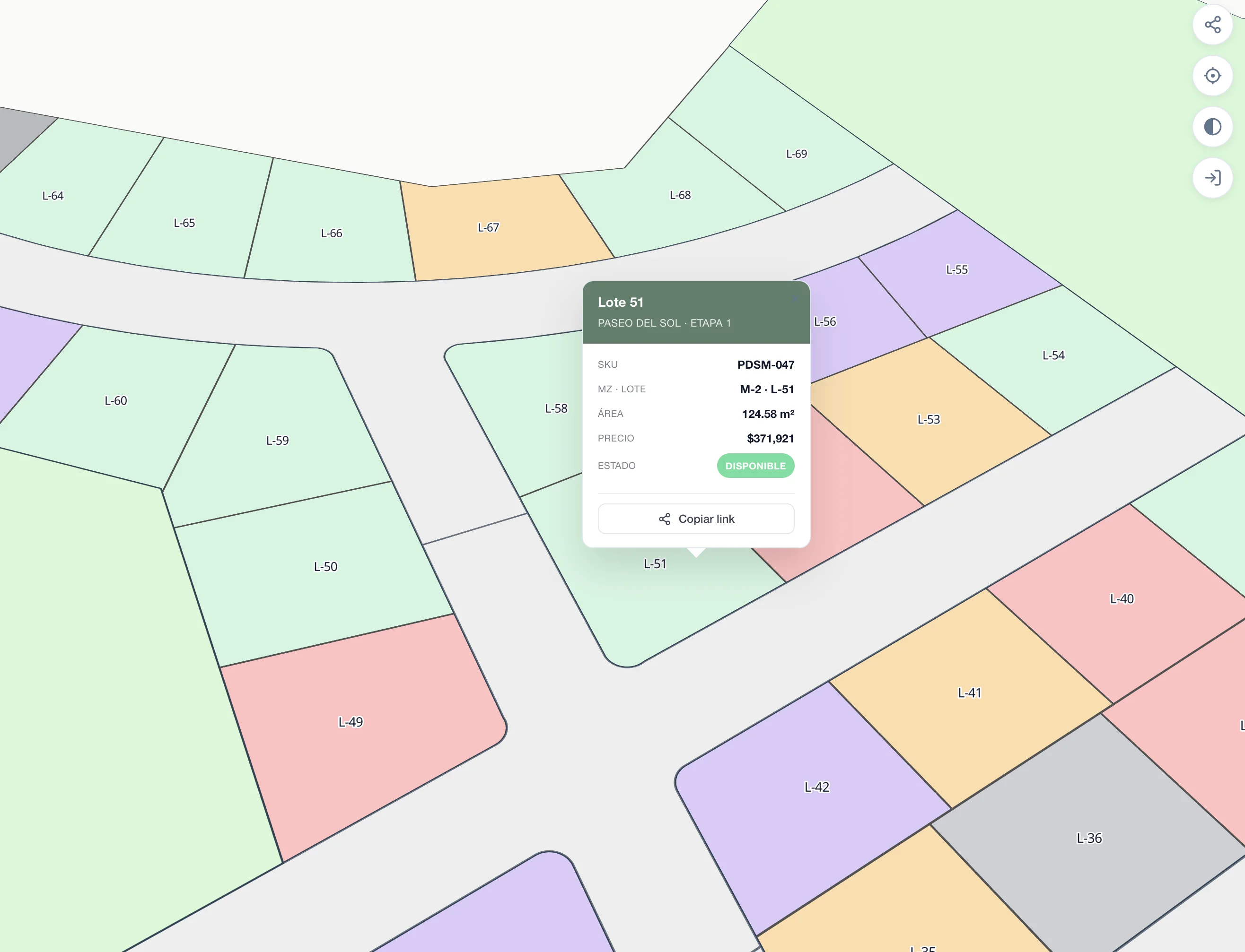
Control de Inventario
Tu información, siempre bajo control
Administra todo tu inventario desde una plataforma simple. Actualiza la información de lotes en tiempo real — sin desarrolladores, sin demoras.
- ✓ Cambia el estado de disponibilidad al instante
- ✓ Actualiza precios y promociones en segundos
- ✓ Todos los cambios se reflejan en vivo en el mapa
- ✓ No se requiere conocimiento técnico
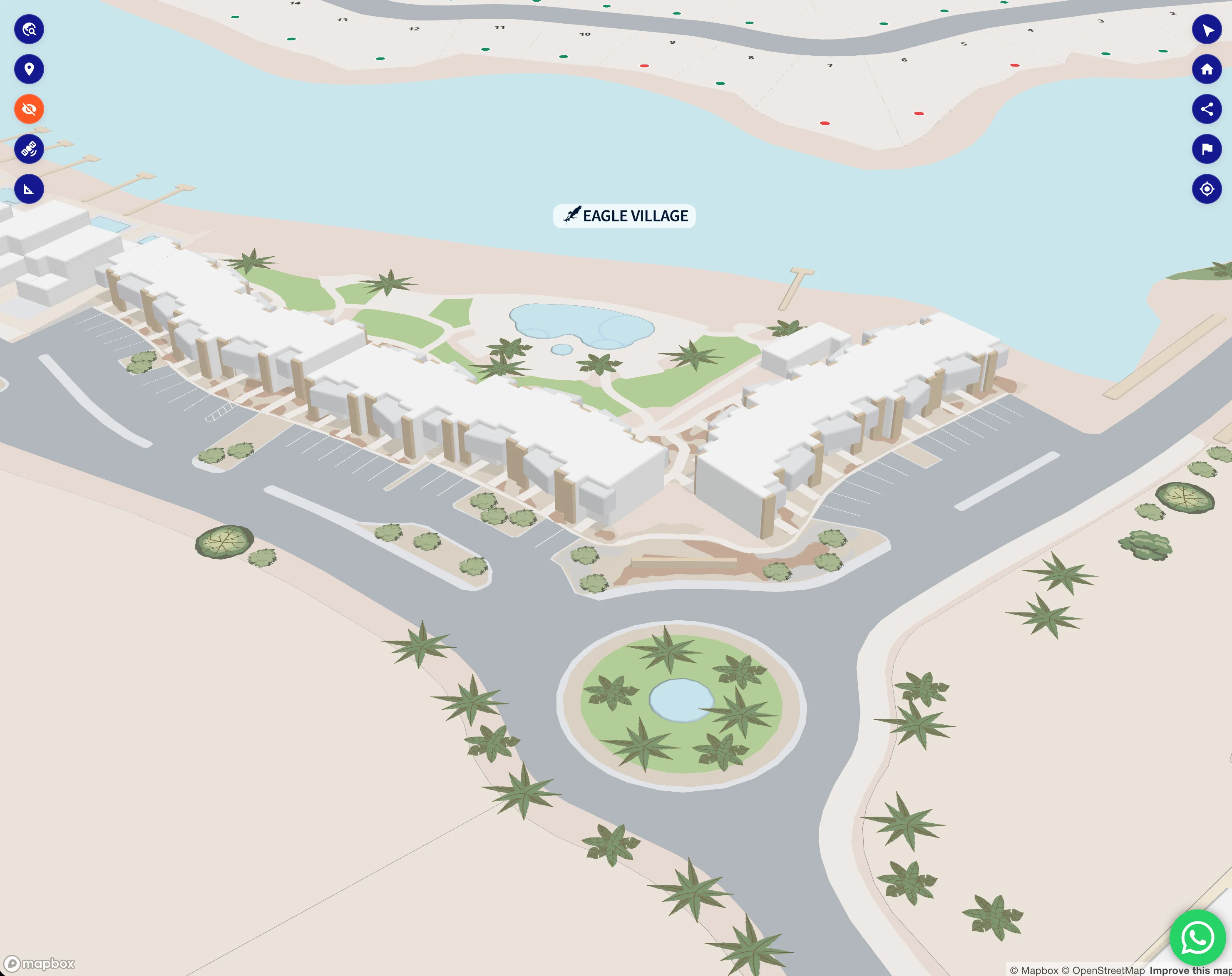
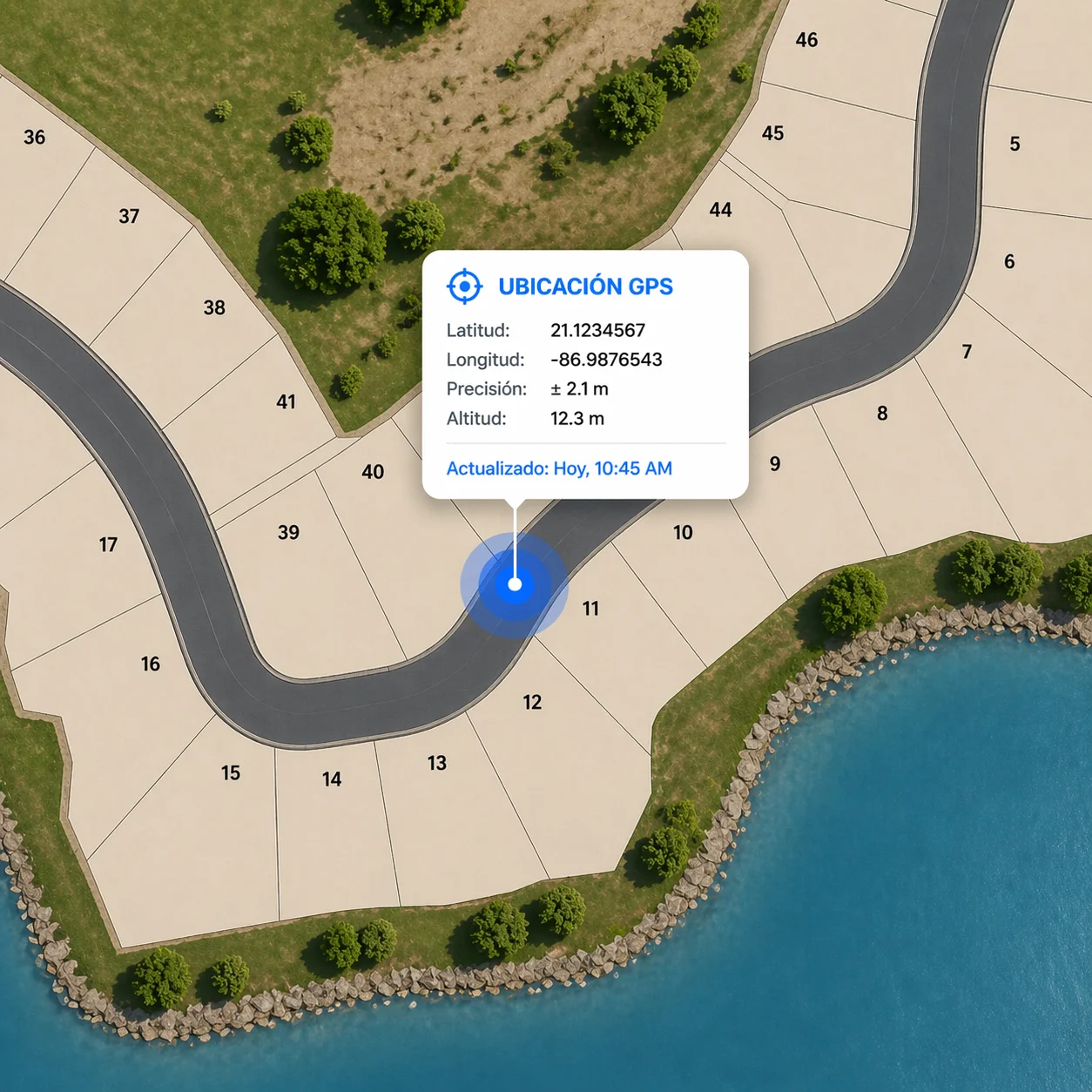
GPS en el terreno
Vende desde el terreno, no desde el render
Tus compradores no tienen que esperar calles, infraestructura ni casas modelo. Con la geolocalización GPS de tu dispositivo, caminan el terreno y ven exactamente dónde estará cada lote — linderos, orientación, vistas — sobrepuesto al mundo físico en tiempo real.
Empieza la preventa desde el día uno, antes de que llegue la primera máquina.
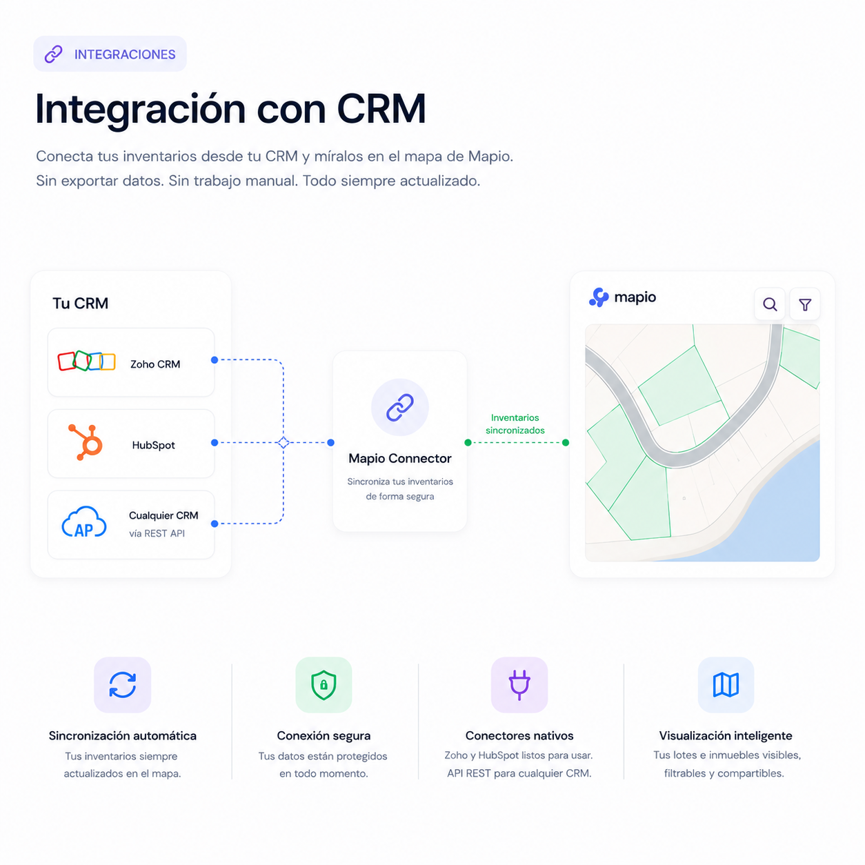
Integración con CRM
Conecta Mapio con tu sistema de ventas
Cada click en un lote, filtro o link compartido puede caer en tu CRM con atribución completa. Conectores nativos para Zoho y HubSpot, y endpoints REST para cualquier sistema custom — sin exportar a mano, sin silos de datos.
- Conectores nativos Zoho · HubSpot
- Endpoints REST custom para cualquier CRM
- Atribución por lead + eventos de actividad
Tu equipo de ventas sigue trabajando en las herramientas que ya usa. Mapio solo les pasa mejores leads.
Precios
Una plataforma. Un precio.
Paga una vez y hospédalo en tu propio servidor. Agrega módulos solo cuando los necesites.
Mapio
Mapa interactivo auto-hospedado para bienes raíces. Corre en tu propio hosting PHP — pago único, sin mensualidad.
- Auto-hospedado en tu propio servidor
- Imágenes satelitales + ortofotos estándar
- Estilos de relieve y terreno 3D
- Polígonos georreferenciados con estado
- Mapas privados + links de acceso por lead
- Panel admin + importar/exportar CSV
- Links directos a lotes + FAB de WhatsApp
- Geolocalización GPS en el mapa
- Sin mensualidad