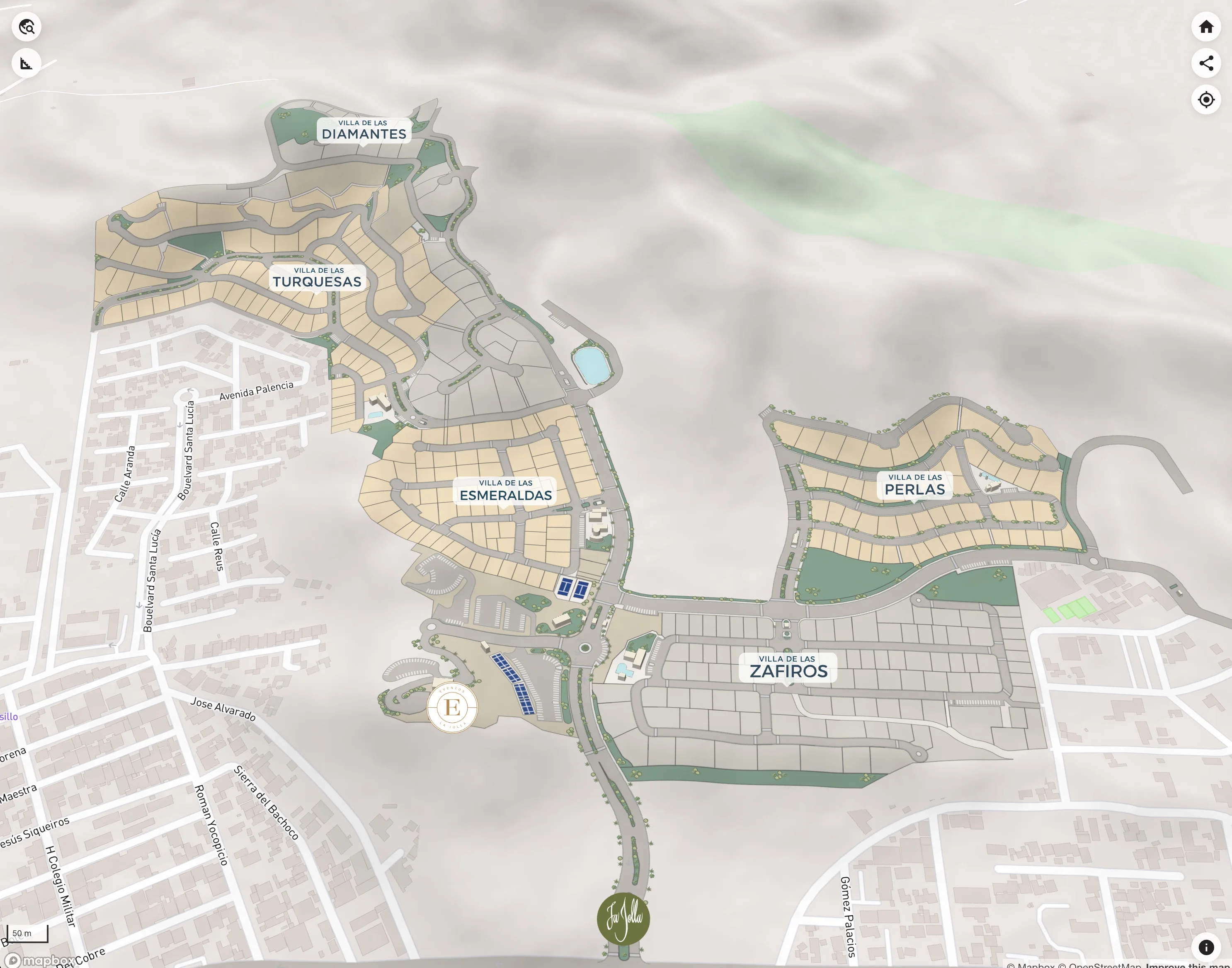
The ease of Google Maps with the information of your project
Show your masterplan in detail with its inventory and project information, always up to date and always available.
The Problem
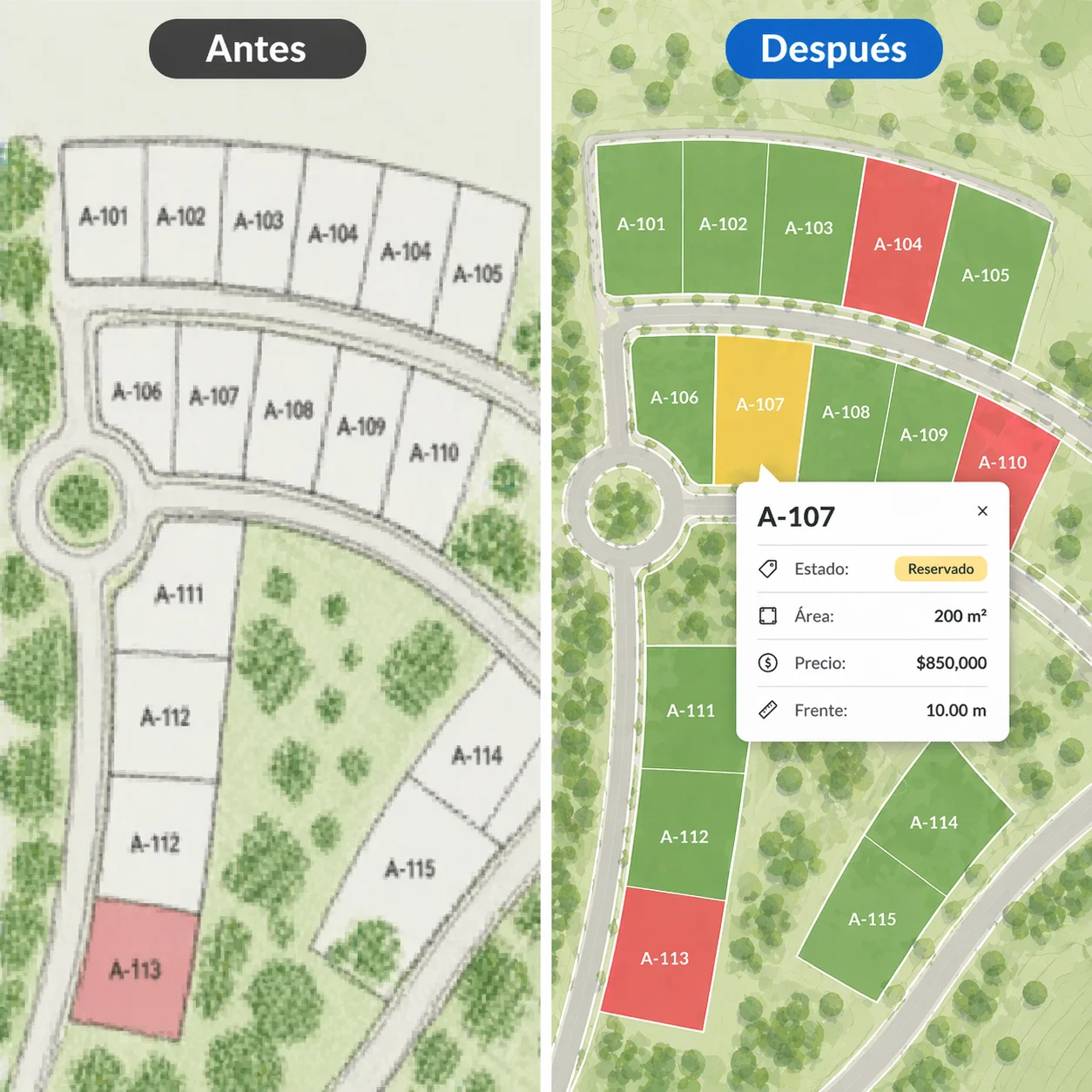
The problem with masterplans today
Static PDFs get outdated. Spreadsheets confuse buyers. Your sales team spends more time explaining than selling. And prospects still don't understand where anything is.
Static PDFs or Images
Masterplans get outdated the moment they're printed or exported as an image. Changes mean re-exporting, re-sending, re-explaining.
Confusing Spreadsheets
Buyers can't connect row 247 to a physical location. Your inventory lives in a format no one outside your team understands.
Locked in CAD Software
Your masterplan lives in AutoCAD or Civil 3D — tools that require technical expertise. No one outside engineering can open, read, or share them.
Outdated Availability
"Is that lot still available?" No one knows for sure without checking three different sources.
The Solution
Let your project speak for itself
Transform your masterplan into an interactive map where every unit is explorable, inventory updates in real time, and one link gives anyone full project clarity.
"Stop explaining your project. Let people explore it."
- ✓ 100% browser-based — no installation required
- ✓ Always up to date — no manual syncing
- ✓ Works on desktop, tablet, and mobile
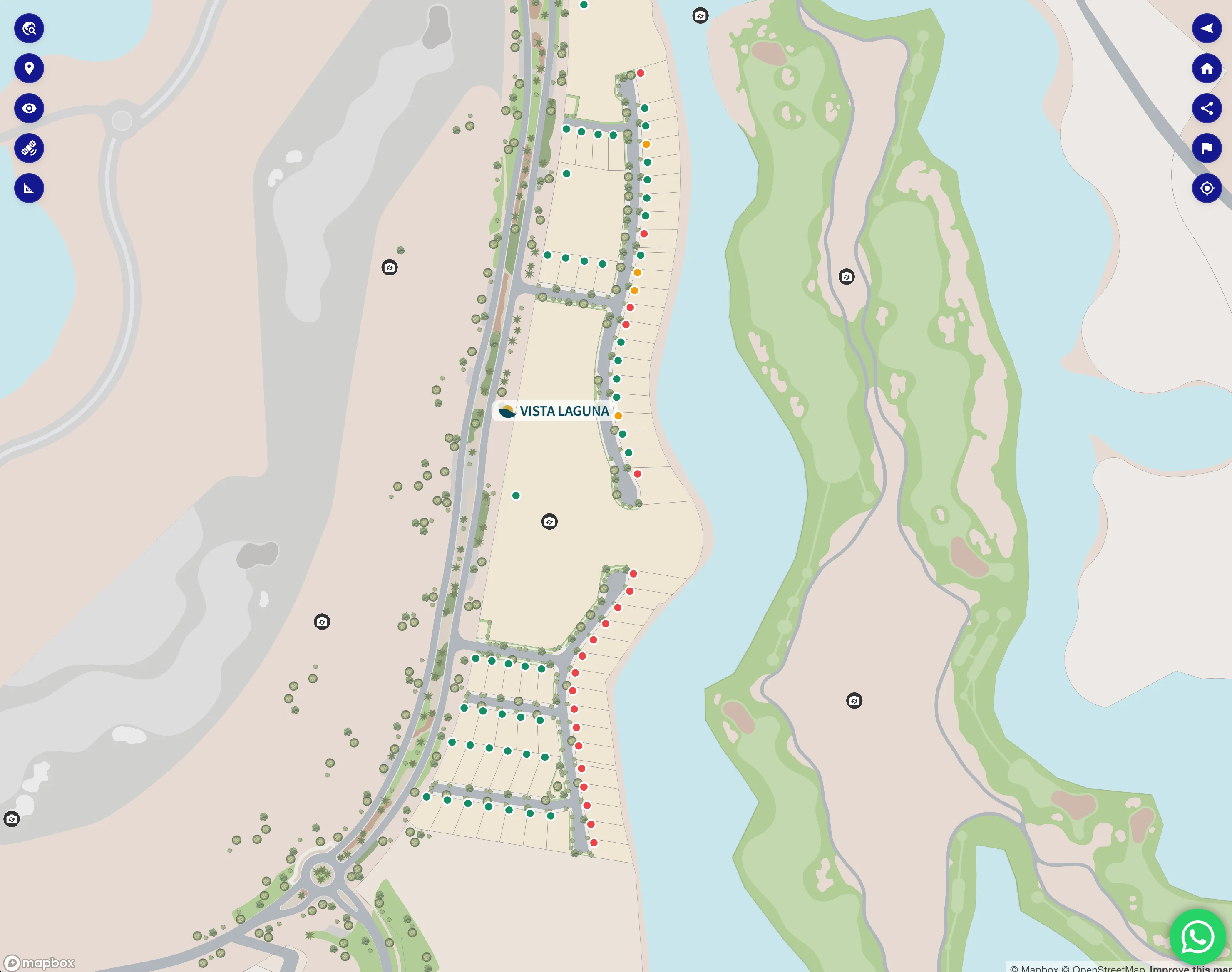
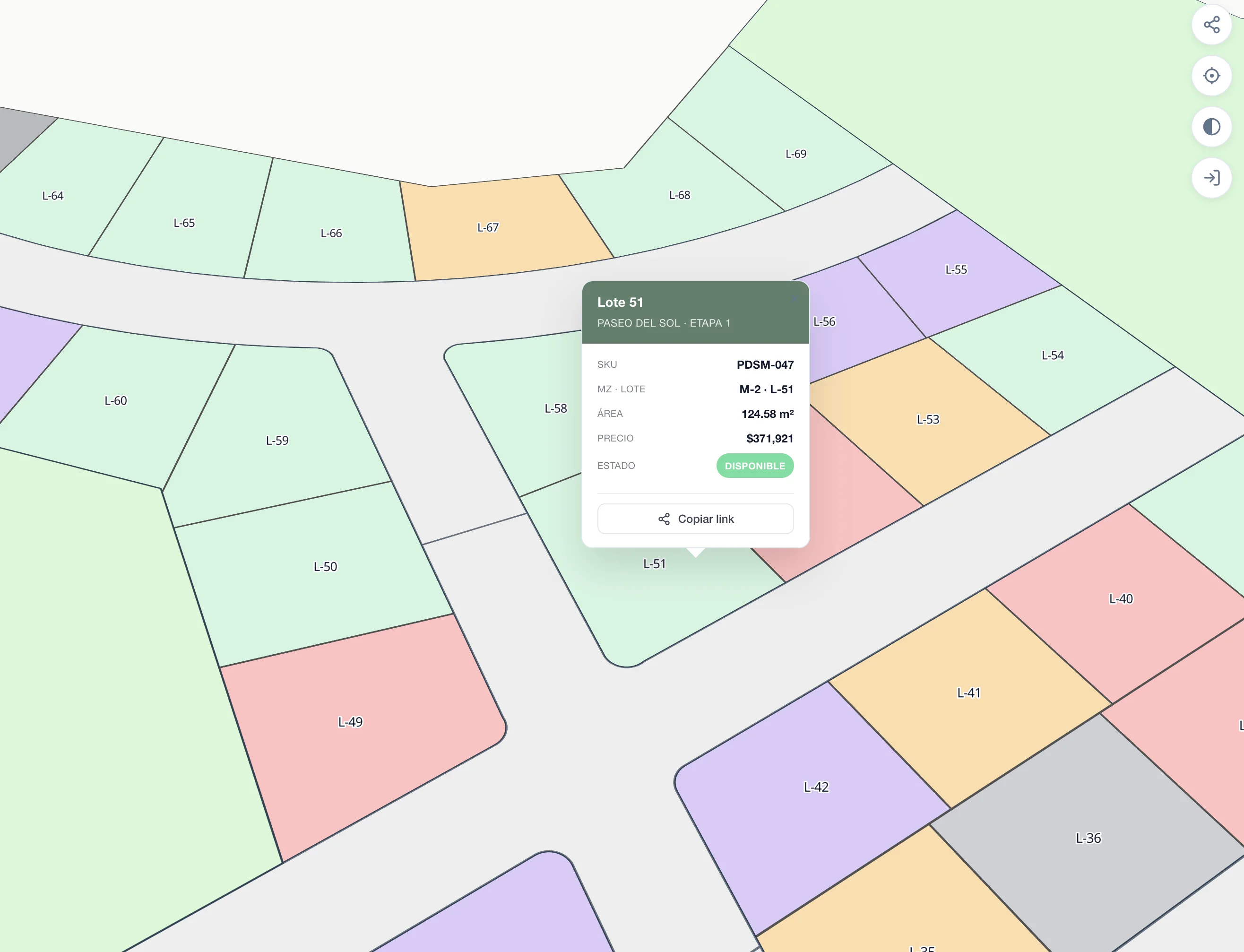
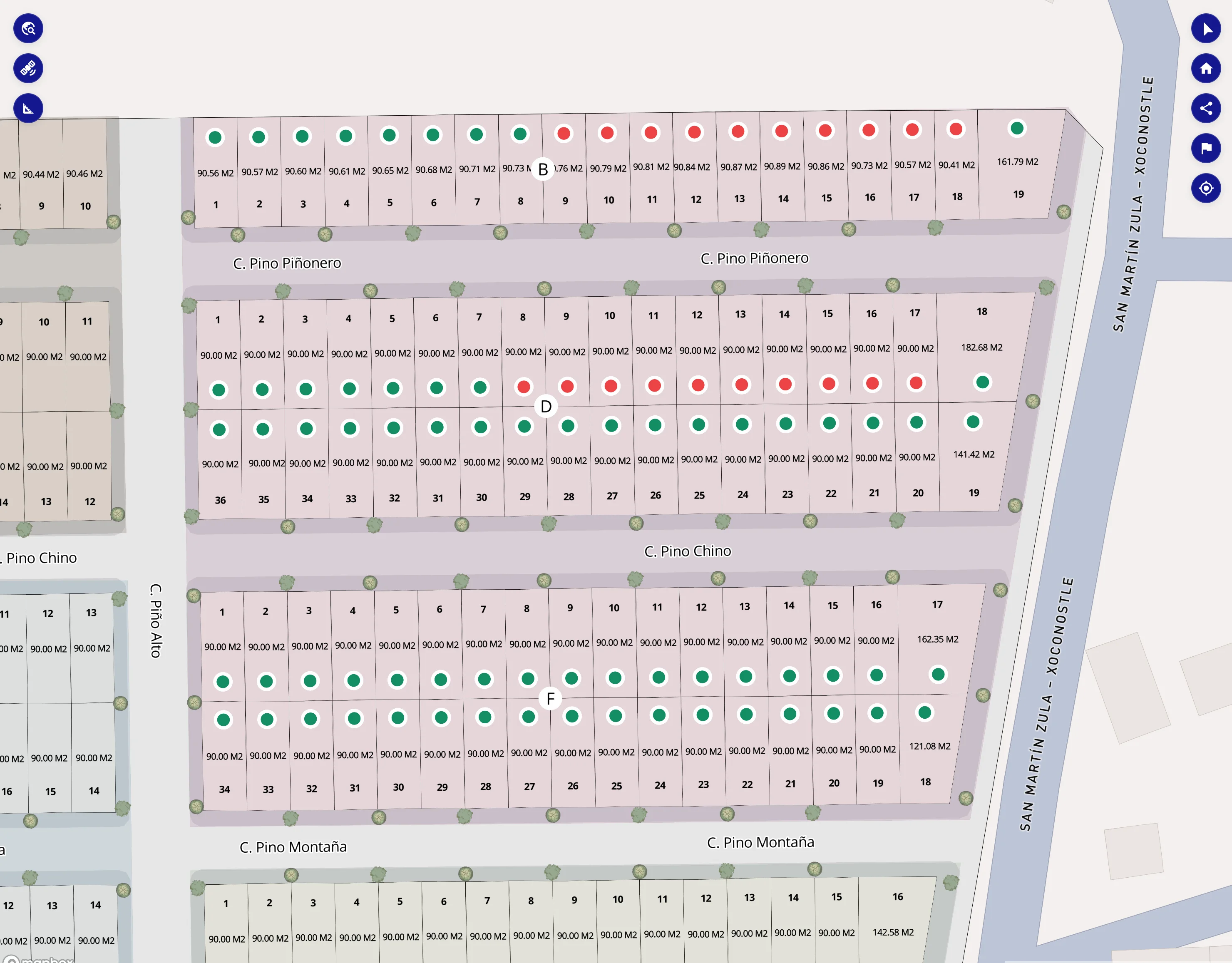
Inventory Control
Your data, always under control
Manage your entire inventory from a simple platform. Update lot information in real time — no developers needed, no delays.
- ✓ Change availability status instantly
- ✓ Update prices and promotions in seconds
- ✓ All changes reflected live on the map
- ✓ No technical knowledge required
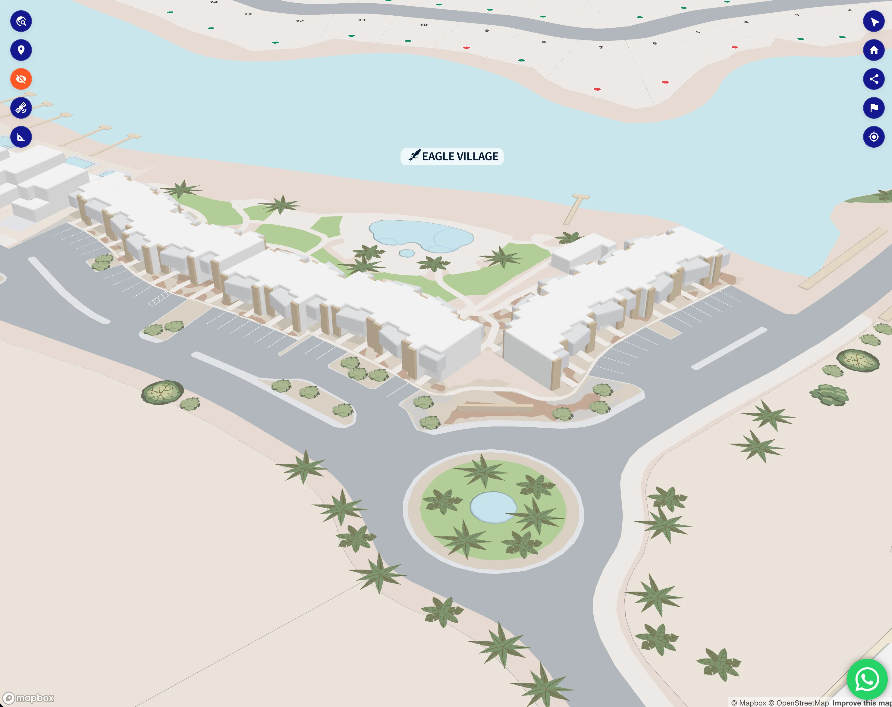
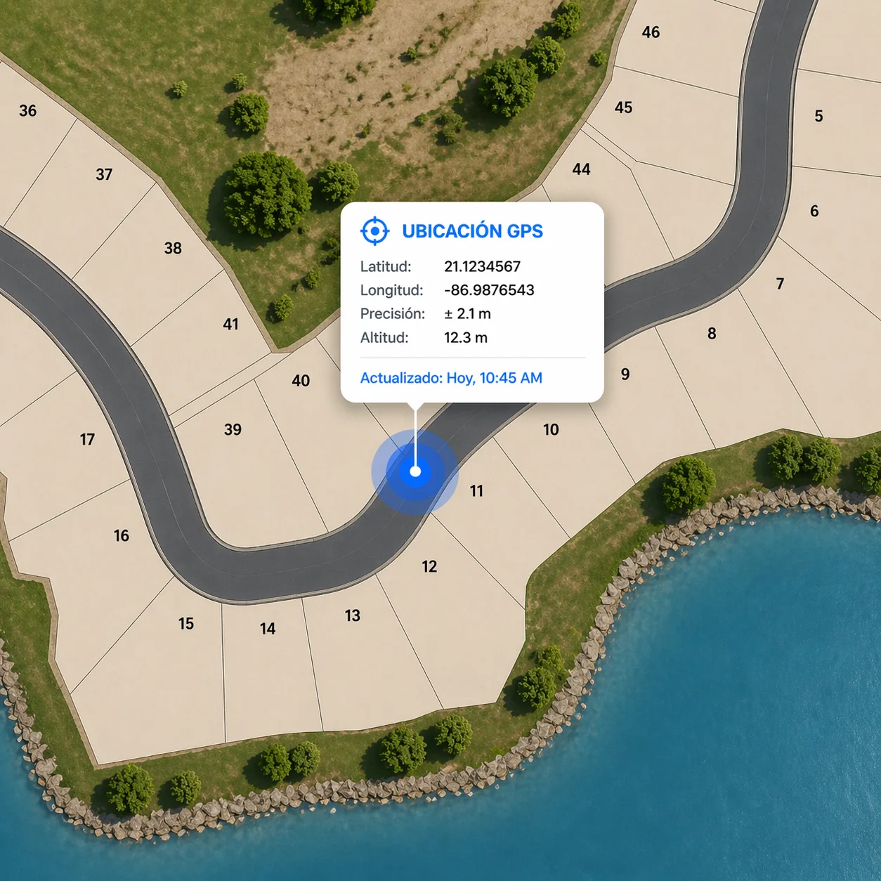
GPS on the ground
Sell from the land, not the render
Your buyers don't have to wait for streets, infrastructure, or a model unit. With their device's GPS location, they walk the raw land and see exactly where each lot will sit — boundaries, orientation, views — overlaid on the real world in real time.
Start pre-sales from day one, before the first bulldozer arrives.
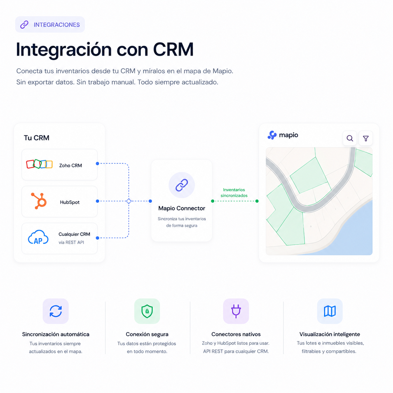
CRM integration
Connect Mapio to your sales stack
Every lot click, filter, or shared lot link can land in your CRM with full attribution. Native connectors for Zoho and HubSpot, plus REST endpoints for any custom system — no manual exports, no data silos.
- Zoho · HubSpot native connectors
- Custom REST endpoints for any CRM
- Per-lead attribution + activity events
Your sales team works in the tools they already use. Mapio just feeds them better leads.
Pricing
One platform. One price.
Pay once and host it on your own server. Add modules only when you need them.
Mapio
Self-hosted interactive map for real estate. Runs on your own PHP hosting — pay once, no monthly fees.
- Self-hosted on your own server
- Satellite imagery + standard orthophotos
- 3D terrain & relief styles
- Georeferenced polygons with status colors
- Private maps + per-lead access links
- Admin panel + CSV import/export
- Shareable lot links + WhatsApp FAB
- GPS device location
- No monthly fees